Remote Sensing and Drone-Based AQ Systems for Real-Time Air Monitoring
Capture accurate, high-resolution air quality data using next-gen drone and remote sensing systems for smart environmental management.
Advanced Drone & Remote Sensing Solutions for Wide-Area Air Quality Monitoring
Remote sensing and drone-based air quality (AQ) systems are transforming the way industries collect and analyze environmental data. By deploying advanced sensors via drones or stationary platforms, these systems enable high-resolution, wide-area monitoring of pollutants and atmospheric conditions—providing unmatched flexibility, speed, and coverage. From mapping industrial emissions to monitoring wildfire smoke dispersion, this technology helps organizations detect, respond to, and manage air quality issues with precision.
Air Quality Instruments delivers fully integrated drone and remote sensing solutions tailored for B2B clients across North America. With a reputation for innovation and system reliability, our offerings help businesses operate smarter and stay compliant with evolving regulatory demands. Whether monitoring urban centers, industrial facilities, or remote regions, our technologies combine real-time data capture with cloud-based analytics for actionable insights and scalable deployment.
Core Components of Remote Sensing and Drone-Based AQ Systems
In addition to offering products and systems developed by our team and trusted partners for Remote Sensing and Drone-Based AQ Systems, we are proud to carry top-tier technologies from Global Advanced Operations Tek Inc. (GAO Tek Inc.) and Global Advanced Operations RFID Inc. (GAO RFID Inc.). These reliable, high-quality products and systems enhance our ability to deliver comprehensive technologies, integrations, and services you can trust. Where relevant, we have provided direct links to select products and systems from GAO Tek Inc. and GAO RFID Inc.
Core Components
- Drones and UAV Platforms – Supported by Industrial Tablet PCs for ruggedized field control, diagnostics, and flight system management.
- Multi-Gas Sensor Payloads – Enabled by Multi-Gas Detectors to capture and measure multiple airborne pollutants simultaneously.
- Thermal and Optical Cameras – Backed by Infrared Thermometers & Cameras for precise thermal imaging and heat mapping of pollutant plumes.
- Ground-Based Remote Sensors – Calibrated using DOAS and IR-compatible Optical & Imaging Sensors for accurate long-range pollutant detection.
- GPS and Telemetry Modules – Integrated with GPS IoT Trackers/Devices for real-time geospatial tracking and flight data synchronization.
- Weather and Wind Sensors – Enhanced by Anemometers to measure wind speed and direction for context-rich air quality assessments.
- Flight Control & Mission Planning: Intuitive interface for autonomous flight path setup, waypoint definition, and repeatable survey missions.
- Data Visualization Suite: GIS-based tools for mapping pollutant concentrations across terrain, rooftops, and urban zones.
- Sensor Calibration Interface: Enables in-field calibration and diagnostics for maintaining high sensor accuracy.
- Automated Data Logging & Export: Real-time and post-flight data export in CSV, GeoJSON, and API formats.
- Regulatory Reporting Module: Generates formatted reports to comply with EPA and ECCC air monitoring mandates.
- Live Data Sync: Stream sensor data in real time from UAVs to secure cloud servers via LTE or satellite uplink.
- Remote Dashboard Access: Web-based portal for managing missions, reviewing historical data, and accessing sensor analytics.
- Alert System Integration: Threshold-based alerting via SMS, email, or push notifications for rapid response.
- Fleet and Site Management: Manage multiple drone units and remote sensor installations across varied geographies.
- Data Archive & Audit Logs: Long-term secure storage of environmental data for trend analysis and policy reporting.
Key Features and Functionalities
- High-resolution, geotagged pollutant mapping over large or hard-to-reach areas
- Customizable payloads for mission-specific pollutant tracking
- Real-time streaming and post-mission data analysis
- Autonomous flight, takeoff, and landing with safety protocols
- Compatibility with rugged environments and emergency deployments
- Integration-ready with SCADA, GIS, and smart city frameworks

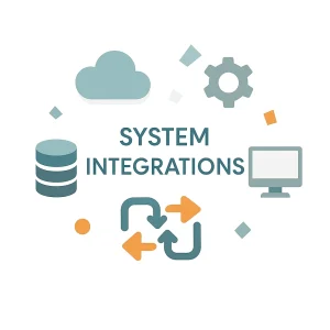
Integrations & Compatibility
Our drone-based and remote sensing AQ systems are engineered to integrate with:
- Environmental Data Platforms (AirNow, OpenAQ, etc.)
- GIS Mapping Software (ArcGIS, QGIS)
- Smart City Networks and Environmental IoT Hubs
- Industrial SCADA and environmental compliance platforms
- Centralized cloud-based control centers for large facility operations
Benefits of Our Remote Sensing & Drone-Based
- Greater Coverage: Monitor expansive or hazardous regions that are inaccessible to ground teams.
- Rapid Deployment: Immediate response to pollution events, fires, or industrial leaks.
- Regulatory Assurance: Stay ahead of compliance needs through early detection and ongoing data collection.
- Reduced Labor and Downtime: Automated missions lower human resource demands while enhancing accuracy.
- Scalable Insights: Aggregate data from fleets of drones and fixed sensors for regional or national environmental programs.
- Precision Decision-Making: Use spatial pollutant patterns to optimize operations or emergency responses.
Applications
- Emergency response to wildfire or chemical spills
- Urban air quality monitoring and traffic emissions studies
- Leak detection in oil & gas fields
- Agricultural chemical drift monitoring
- Construction and demolition site compliance
- Smart city environmental infrastructure
- Research in climatology and pollutant transport
Industries Served
Environmental Protection & Monitoring Agencies
Energy, Oil & Gas
Agriculture & Land Management
Smart Cities & Municipal Governments
Industrial Manufacturing
Mining and Extraction
Public Safety & Disaster Management
Relevant U.S. & Canadian Standards
U.S. EPA Clean Air Act – Ambient Air Monitoring Guidelines
U.S. FAA Part 107 – Drone Regulations for Commercial Use
Canadian Aviation Regulations (CARs) – RPAS Guidelines
Case Studies
Wildfire Smoke Mapping – Northern California
Following a series of intense wildfires, a state agency deployed Air Quality Instruments’ drone-based AQ systems to map fine particulate pollution across impacted rural communities. Real-time data allowed emergency managers to make timely evacuation and aid decisions while providing critical insights into public health risk zones.
Urban Traffic Emissions Study – Houston, Texas
A metropolitan planning authority used our UAV platform to monitor vehicle-related NO₂ and VOC emissions along major roadways. By correlating the data with traffic flow and weather patterns, the agency improved its air pollution mitigation strategy and optimized road use policies.
Oil Field VOC Surveillance – Alberta, Canada
An energy company partnered with Air Quality Instruments to survey methane and VOC emissions using drones equipped with precision gas sensors. The project helped meet Alberta’s methane reduction targets by enabling real-time detection of fugitive emissions and improving maintenance scheduling.
Ready to take air quality monitoring airborne?
Contact Us today to learn how Air Quality Instruments can deliver drone and remote sensing solutions tailored to your operational, regulatory, and research needs.